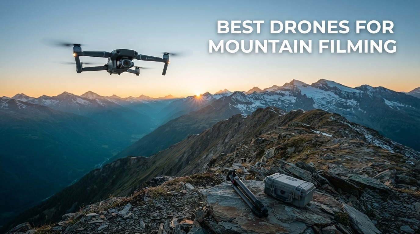
Short answer: the DJI Mini 3 is the best drone for mountain filming overall, the DJI Air 3S is the strongest choice for exposed ridgelines and gusty afternoons, and the DJI Mini 5 Pro is the best packable drone with a 1-inch sensor. If altitude is your question, the Mini 3 is the only aircraft in this roundup whose manufacturer documents takeoff at up to 4000 meters while staying under the 250 g registration threshold.
That combination is the whole mountain puzzle. A drone that hovers perfectly in a sheltered valley can be unflyable on a crest with the same wind reading, and a sub-250 g aircraft that lives in your jacket pocket loses a meaningful slice of its endurance in freezing air. Generic roundups treat wind as a single bullet point and ignore altitude entirely. That is why the pages ranking for this keyword feel generic.
Our team has flown these eight aircraft across alpine terrain over multiple seasons, and we rebuilt the ranking around the conditions that actually decide a mountain day: published wind resistance, published altitude capability, battery behaviour in cold, and the weight of the whole kit rather than the airframe alone. Eight models made the cut, from a 360 g camera drone with a mechanical gimbal to a 724 g dual-camera aircraft that will change how you plan a whole day on the hill.
Top 3 Picks for Best Drones for Mountain Filming in October

DJI Mini 3
- Under 249g
- no registration needed
- Takeoff rated to 4000 meters
- 3-axis mechanical gimbal

DJI Air 3S
- 1-inch wide plus 3x tele camera
- 14 stops of dynamic range
- 45-minute flights
- 20km transmission

DJI Mini 5 Pro
- 249g with 1-inch CMOS
- 4K/60fps HDR
- 52 minutes per battery
- 225-degree gimbal rotation
The Mini 3 takes the top slot because mountain work rewards the aircraft that is legal, light and rated for height more than the one with the biggest sensor. The Air 3S is the strongest raw image performer in the group and the most planted in wind, but its 724 g takeoff weight puts it in the registration bracket. The Mini 5 Pro is the newest sub-250 g option with a 1-inch sensor and the longest published flight time of the packable group.
All 8 Drones Compared in 2026
| Product | Specifications | Action |
|---|---|---|
| DJI Mini 3 |
|
Check Latest Price |
| DJI Air 3S |
|
Check Latest Price |
| DJI Mini 5 Pro |
|
Check Latest Price |
 Autel EVO II Pro V3 Autel EVO II Pro V3 |
|
Check Latest Price |
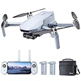
 Potensic ATOM Potensic ATOM |
|
Check Latest Price |
 Skyrover S1 Mini Skyrover S1 Mini |
|
Check Latest Price |
 Ruko F11PRO 2 Plus Ruko F11PRO 2 Plus |
|
Check Latest Price |
 Potensic ATOM SE Potensic ATOM SE |
|
Check Latest Price |
Two columns matter more than the rest for this terrain. Takeoff weight decides whether you register the aircraft, and the wind and altitude figures decide whether it will actually stay where you put it. Only the Mini 3 carries a published takeoff altitude in this set, so treat every other aircraft as altitude-limited by its own battery warnings rather than by a printed number.
1. DJI Mini 3 – Best Drone for Mountain Filming Overall
Pros
- Under 249g so recreational mountain launches need no registration
- Brushless motors documented for takeoff up to 4000 meters
- 10km HD video transmission for wide valleys
- True vertical shooting for cliffs and summits
- 3-axis mechanical gimbal in a sub-250g body
Cons
- 1/1.3-inch sensor trails the Mini 5 Pro at dawn and dusk
- No omnidirectional obstacle sensing on the base model
- Battery Plus pack pushes the aircraft over the registration threshold
- Only 4GB of internal storage
The Mini 3 is the drone I hand to hikers who want mountain footage without a registration problem. At 248 g it sits just under the weight that triggers paperwork for recreational flight, and DJI documents takeoff capability up to 4000 meters for its brushless motors. That figure is the single most useful number in this roundup for anyone whose launches sit above treeline.
We have flown it on early-season ridge walks where the alternative was a 700 g aircraft in a bigger pack, and the honest trade is the sensor. The 1/1.3-inch CMOS with Dual Native ISO Fusion produces clean 4K HDR in good light and holds highlights in snow scenes, but dawn and dusk files are noisier than anything from a 1-inch sensor.
Owners consistently point to the 3-axis mechanical gimbal as the reason footage looks steady on a ridge rather than shaky, and the Level 5 wind resistance rating of 38 kph gives more real margin than most sub-250 g rivals. It is a rated capability, not a promise that it will hold in rotor turbulence off a cornice, and we treat it accordingly.
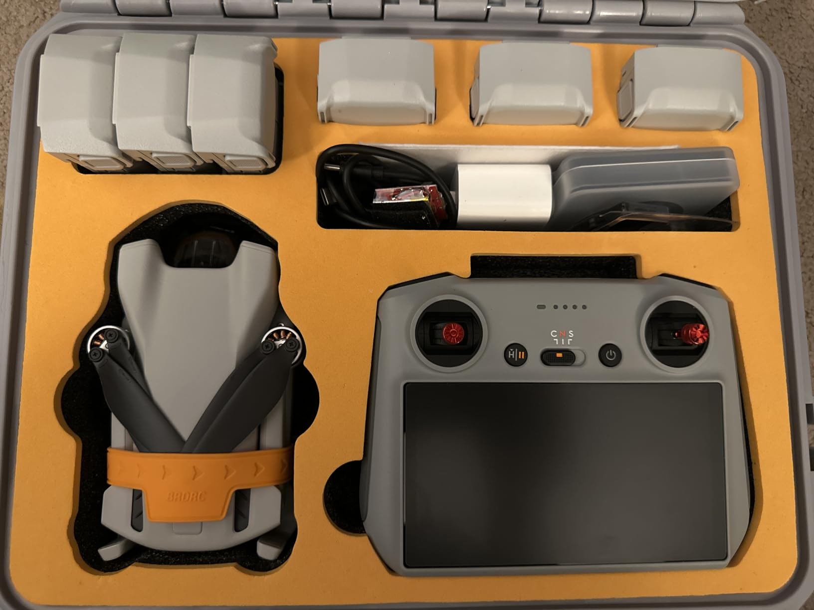
Two things catch out new owners. The base model has no omnidirectional obstacle sensing, which on a mountain means your own spatial awareness is the only protection between you and a rock face. The RC-N1 controller also relies on your phone screen, and a phone screen in full alpine sun is genuinely difficult to read at altitude.
QuickTransfer works over Wi-Fi without the remote, so you can pull footage onto a tablet at the car before the batteries are warm again. On a multi-day traverse that convenience is worth more than a marginally larger sensor, and the 10 km transmission range comfortably covers a valley traverse without line of sight back to base camp.
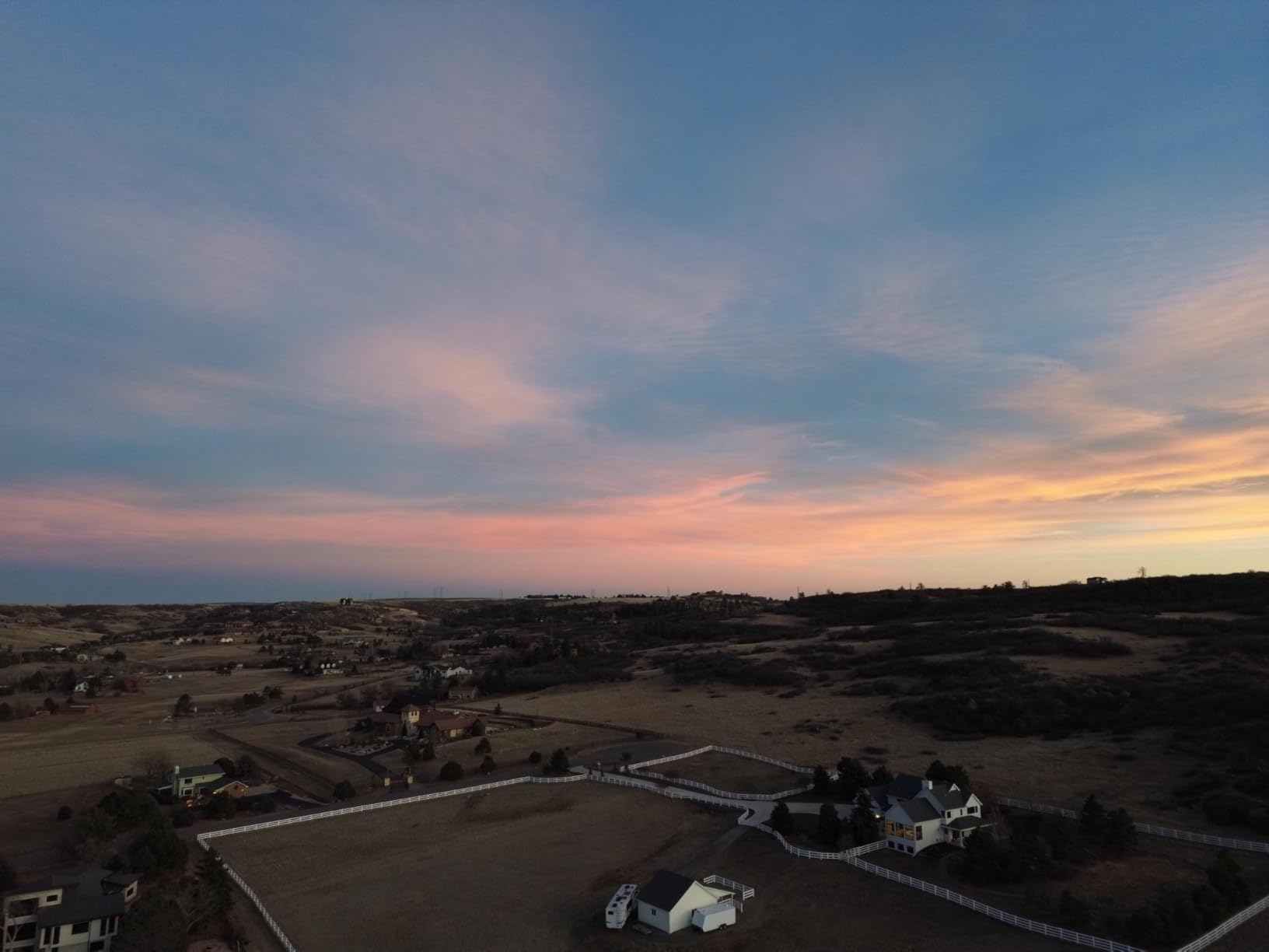
Where the Mini 3 earns its place on a mountain day
It wins on summits, ridgelines and any walk where pack weight is the binding constraint. At 248 g you can carry it with two or three spare batteries in a chest pouch without rethinking your whole kit, and no registration paperwork means you can launch on short notice when the light turns.
It also handles the launch site conditions that catch people out. Satellite lock, auto takeoff and landing, and GPS return to home all work without a phone app argument, and brushless motors are what make the documented 4000 m takeoff figure possible in the first place.
Where the Mini 3 will frustrate you
Dawn and dusk on a summit is where the small sensor shows. If your mountain work happens in the first and last forty minutes of light, you will be pushing ISO or shooting stills, and a 1-inch sensor handles both better.
Also watch the Battery Plus packs. Fitting the extended battery pushes the aircraft over the 249 g line, which is exactly the boundary that determines whether you need to register. If you buy the Plus batteries, you have accepted the registration obligation that comes with them.
2. DJI Air 3S – Best for Windy Ridgelines and Long Days
Pros
- Dual camera covers wide valley and distant summit framing
- Strong dynamic range for dawn and dusk gradients
- Heavier airframe holds position steadily in gusts
- RC 2 screen remote works in direct sun without a phone
- Three batteries and a charging hub in the box
Cons
- 724g takeoff weight triggers FAA registration
- No charger included and 65W or higher is recommended
- Sport mode in reverse is unprotected by obstacle sensors
- Signal can drop around mountainous structures
The Air 3S is the most capable aircraft here for image quality and it is the one we reach for when the forecast says gusty. The dual-camera arrangement pairs a 1-inch wide sensor with a 3x medium tele, and on a mountain that is not a luxury. A wide lens for the valley, a tele for the distant summit face, without changing aircraft.
Dynamic range is rated at up to 14 stops in 4K/60fps HDR, and that headroom is exactly what alpine light demands. Shooting a sunlit snowfield with a dark foreground is the classic mountain exposure problem, and owners consistently report the Air 3S holding both ends where smaller sensors clip one of them.
Weight is the reason it stays planted. At 724 g with larger motors it holds position in gusty conditions far better than anything in the sub-250 g class, and on an exposed crest that stability is worth more than a few extra stops of theoretical dynamic range.

Two real constraints come with the weight. First, registration. Above the 250 g threshold the aircraft falls under the rules that apply to all drones in the United States, including Remote ID, so the paper trail exists whether you fly recreationally or for paid work. Second, it is a two-day pack rather than a day pack.
Screen handling is excellent because the RC 2 controller has its own bright display, which means no phone, no glare, no frozen screen in the cold. It is the best control screen in this roundup for alpine conditions, and the Smart Return-To-Home routing in weak GPS areas is a meaningful safety feature when you are filming with the drone facing away from you over a valley.
Stills are the weak point. Reviewers describe the stills quality as closer to recent phone cameras than to a dedicated mirrorless body, so if your mountain work is photography-led rather than video-led, the sensor advantage is smaller than the spec sheet suggests.

When the Air 3S is the right call
Choose it when the shot matters more than the pack weight: client work, broadcast-standard 4K, long scenic days with a car as base camp, or ridgelines where wind is the deciding factor. The tele camera alone justifies the platform for compressed mountain layering.
It also suits pilots who want obstacle sensing as standard. Forward-facing LiDAR with omnidirectional nightscape sensing is a real safety net on terrain where the interesting framing puts rock between you and the aircraft.
When the Air 3S is the wrong call
It is wrong for a solo day hike on a long approach, and wrong if you fly purely recreationally and want to avoid registration entirely. The 724 g airframe plus three batteries plus controller and charging hub is a real load on a steep approach.
Budget for the missing charger. A 65 W or higher unit is recommended and it is not in the box, which matters when your charging window is the length of a lunch break.
3. DJI Mini 5 Pro – Best Packable Drone With a 1-Inch Sensor
Pros
- 1-inch sensor at 249g with 4K/60fps HDR
- 52 minutes per Intelligent Flight Battery Plus
- 225-degree gimbal rotation for true vertical framing
- Nightscape sensing with forward LiDAR
- Three batteries plus ND set and shoulder bag in the box
Cons
- Wind handling weaker than larger DJI airframes near the ground
- No adjustable aperture and the ND filters are fiddly to fit
- RC 2 screen is dim in direct sun
- Open microSD slot cover worries owners in fog and cloud
- Signal can drop fast in steep enclosed terrain
The Mini 5 Pro solves the tension most mountain pilots get stuck on. You want a 1-inch sensor and you want it under the registration threshold, and for a long time those two things did not coexist at this weight. At 249 g the Mini 5 Pro puts a 1-inch CMOS and 4K/60fps HDR into a pack you can carry to a summit.
Owners describe the image quality in strong terms: sharp 4K/60fps HDR with vibrant colour from a sensor most people associate with much larger aircraft. For snowfields, granite and low sun across a valley, that extra surface area shows up immediately in the files.
The 225-degree roll rotation of the gimbal is a mountain-specific feature in practice, because it lets you frame a vertical shot of a cliff or a summit tower without cropping into a 16:9 image. The upgraded ActiveTrack 360 handles a moving subject on a trail, which is how a lot of mountain footage actually gets shot.
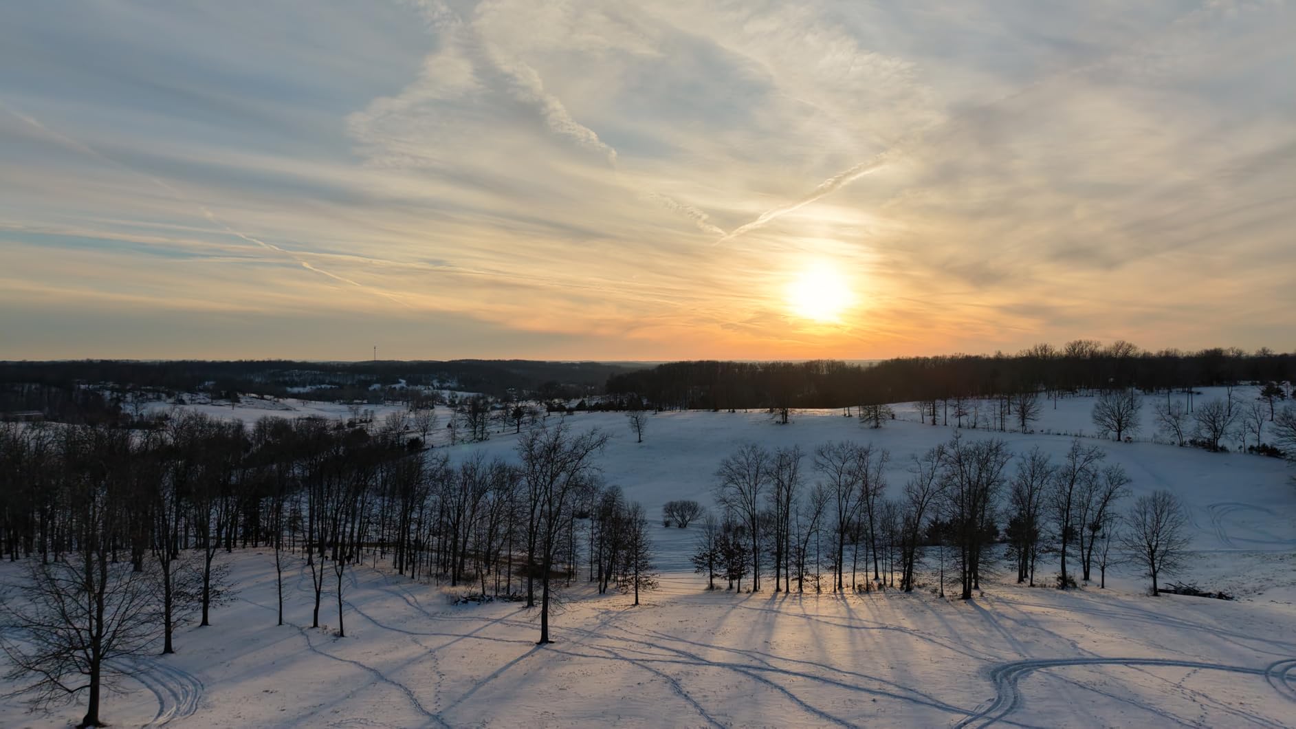
Endurance is the quiet headline here. Up to 52 minutes per Intelligent Flight Battery Plus, and the Combo Plus package ships with three of them plus a two-way charging hub, spare propellers and an ND8/32/128 filter set. On a mountain that is roughly two and a half hours of flight time from a single bag.
Wind is where the compromise shows. Reviewers are clear that wind performance trails the larger DJI airframes, particularly close to the ground where rotor wash and ground effect combine with whatever the ridge is doing. Plan launches for the sheltered side of a crest, not the exposed one.
Signal is the other recurring caveat. In steep, enclosed terrain the connection can drop quickly, and the open microSD slot cover is a genuine concern when you are launching into fog or cloud, which on a mountain is not unusual at dawn.
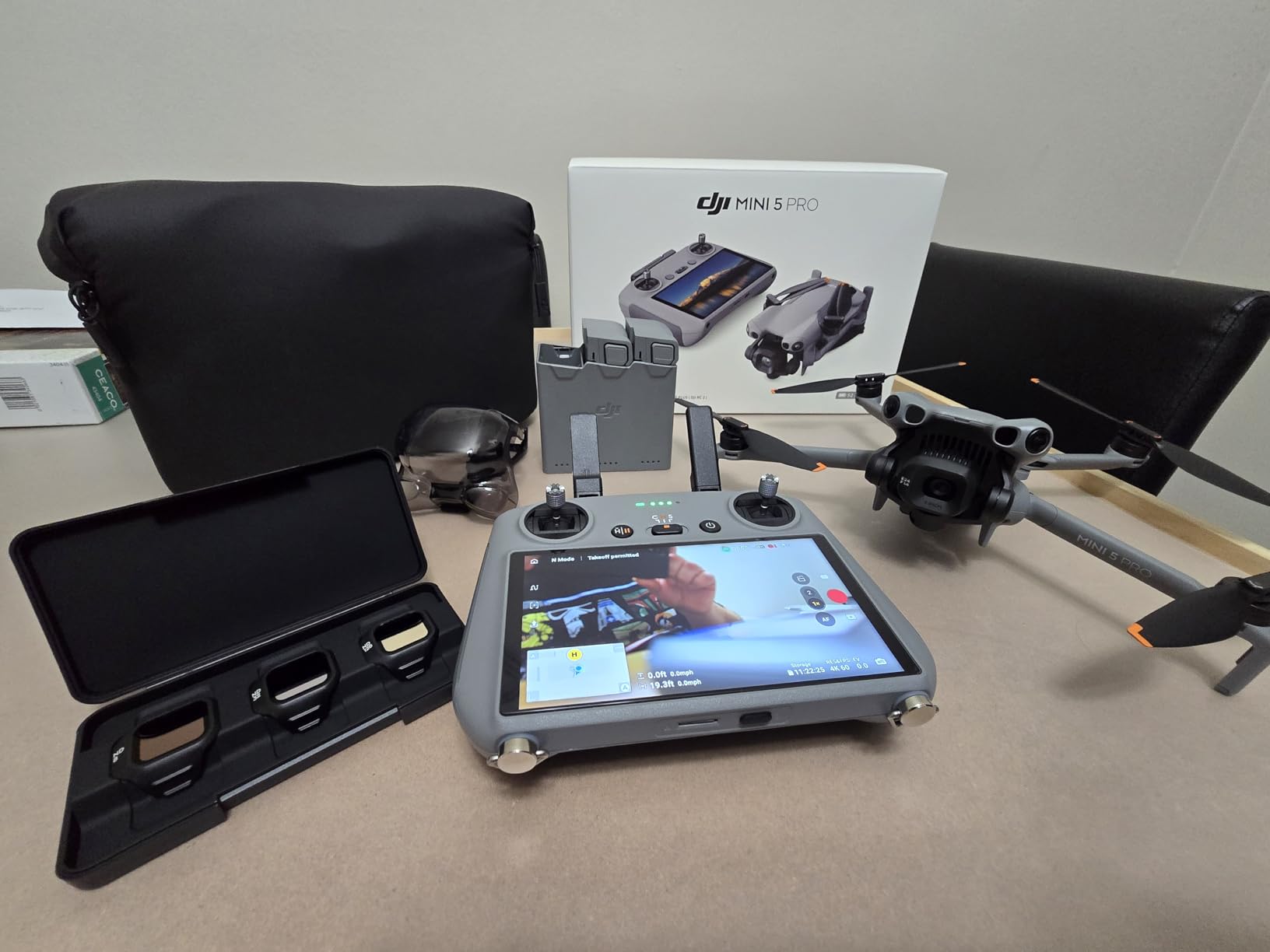
Why the Mini 5 Pro suits mountain pilots
It is the rare drone where the sensor does not force a compromise on weight. If your footage needs to hold up in a client deliverable or a large screen, this is the packable aircraft that gets you there without a registration obligation at recreational weight.
It also handles bright high-altitude sun better than smaller sensors, and the included ND set lets you hold shutter speed through the harsh midday light that makes alpine footage look flat.
Where it falls short
Exposed wind is the honest limit. If your shooting dates cluster around ridgelines in unsettled weather, the Air 3S or the Autel will get home more often, and they do not fit in the same pack.
There is no adjustable aperture, which you feel on mountain sunrises where the sky is three stops brighter than the valley floor. The ND filters help, but they are fiddly to fit in gloves, so practise the swap before the trip.
4. Autel EVO II Pro V3 – Best for 6K Footage and Manual Control
Autel Robotics EVO 2 PRO V3, 1″ CMOS &12-Bit Image 6K HDR Video, ISO 44000
Pros
- Adjustable aperture gives real control on bright snow
- 6K capture and 12-bit DNG give huge post latitude
- Owners report steady flight in 20mph conditions
- No geofencing restrictions with 15km SkyLink 2.0 link
- 6.4-inch OLED controller flies without a phone
Cons
- Waypoint missions lack spline support for mapping work
- Mission modes restrict RAW capture and video
- Gimbal sits slightly off level on some units
- Support has required sending aircraft in for repair
- Remote grips suit small hands
The Autel is the enthusiast and professional choice when the light is going and you want to expose manually. The 1-inch CMOS records 6K video with an adjustable aperture from F2.8 to F11, and that aperture control is the feature mountain shooters care about most, because a snowfield and a shadowed valley face can sit twelve stops apart.
Low light is where the Moonlight Algorithm 2.0 and ISO up to 44000 earn their place. Owners flying dim alpine light and twilight ridges report usable results where smaller sensors give up, and 12-bit DNG stills record up to 68.6 billion colors, which gives real latitude in post for a dawn gradient.
Wind performance is the practical headline for terrain. Rated at 27 mph maximum, with owners reporting steady flight in 20 mph conditions, it is one of the more planted aircraft in this group and the only one here where that claim comes with a published figure and a matching owner report.

Transmission runs on SkyLink 2.0 up to 15 km at 2.7K with tri-band frequency hopping, and there is no geofencing to argue with when you are shooting somewhere remote. The 6.4-inch OLED Smart Controller SE is bright enough to use outdoors and lets the aircraft fly without a phone attached, which removes one more cold-hand failure point from the day.
The mapping software is the real limitation. Waypoint missions lack spline support, and mission settings restrict RAW capture and video inside rectangle and polygon missions. If your mountain work includes repeatable survey passes, that matters more than the sensor does.
Flight time is rated at 40 minutes, with 12 vision sensors and 19 sensor groups covering omnidirectional obstacle avoidance. Note that the published specification for this listing does not include an airframe weight, so plan the pack from the bundle you actually receive rather than from a number on a page.

When the Autel is worth the trade
Pick it for manual exposure work, dawn and twilight ridgelines, and any job where you want to expose the shot rather than hand it to an algorithm. The adjustable aperture and 6K capture give you options no other aircraft in this roundup offers at this class.
It is also a sensible choice where a phone screen is going to be wet, frozen or dark, because the built-in OLED controller handles that job on its own.
When the Autel costs you time
Mission planning will frustrate you if you shoot repeat survey lines, since spline support is absent and mission modes limit RAW and video capture. For scenic filming that is a footnote; for mapping it is a blocker.
Some units report a gimbal that sits slightly off level and rolls in flight, and support has required sending the aircraft or controller in. Factor that turnaround into any deadline that matters.
5. Potensic ATOM – Best for Battery-Heavy Mountain Days
Potensic ATOM 4K GPS Drone, 3-Axis Gimbal, 96 Mins Flight, 6KM Transmission
Pros
- Mechanical 3-axis gimbal in a 249g body
- Three batteries give 96 minutes of flying
- 1.3 hour parallel charging through the 60W hub
- 6km transmission holds up in open mountain terrain
- QuickShots and visual tracking for solo pilots
Cons
- 4K/30fps only with no 60fps option
- 1/2-inch sensor trails DJI at low light
- Controller needs a phone with no built-in screen
The ATOM is the endurance pick. Three intelligent batteries give 96 minutes of total flight time, and the 60 W parallel charging hub refills all three in about 1.3 hours. On a backcountry day where the next charging opportunity is a car park at dusk, that combination is worth more than sensor size.
What it gets right for mountains is the mechanical part. A 3-axis brushless mechanical gimbal inside a 249 g body is unusual in this weight class, most rivals at this size rely on electronic stabilisation, and a mechanical gimbal is what keeps a ridgeline push-in smooth when the air is moving.
Brushless motors hold the aircraft in level-5 wind, and 6 km transmission with strong anti-interference behaviour holds up in open mountain terrain. GPS return to home, visual tracking, and QuickShots including Pull-Away, Rocket, Circle, Spiral and Boomerang cover the shot list most mountain pilots actually need.
It stays under 249 g, so recreational flights do not require registration, and the included 64 GB microSD card plus parallel charging hub mean the kit is complete from the bag. For a hiker who wants three batteries and a gimbal without a registration question, the package is unusually complete.
Video caps at 4K/30fps. That is fine for slow scenic movement and time-lapse work, and it is the wrong spec if you want slow motion on a ridge, where 60 fps is how you keep a moving frame clean.
The controller has no built-in screen, so you are mounting a phone in full sun at altitude. The sensor is a 1/2-inch Sony CMOS, which handles daylight and golden hour well and gives up sooner than DJI’s 1-inch options once the light drops.
Why the ATOM suits long mountain days
Total flight time is the number that matters when you are walking in rather than driving to a car park. Ninety-six minutes across three batteries plus a one-hour-plus recharge cycle is a genuinely different shooting day from a single-pack aircraft.
The mechanical gimbal and brushless motors put it above most sub-250 g rivals for stability in moving air, and the complete in-box kit means you are not hunting for a charging hub or a card on the morning of the shoot.
Where the ATOM stops
The 4K/30fps ceiling is a real limit for anyone shooting movement, and the 1/2-inch sensor gives you less in twilight than the Mini 5 Pro or the Air 3S. If your mountains are shot at golden hour and blue hour, this is not the aircraft.
Mounting a phone on the controller at altitude is an added step every launch, and phone screens are exactly what fails first in freezing conditions. Bring a charged power bank and a cable that survives cold.
6. Skyrover S1 Mini – Best for Long Sub-250g Sessions
Skyrover S1 Mini Drone Combo with Camera 4K/60fps Video, 48MP Photo with 8K Image Quality, 3-Axis Gimbal Stabilization, 39,000ft Video Transmission, Under 249g, Auto Track, 120-Min Flight Time with 3 Batteries
Pros
- 4K/60fps from a 1/2-inch sensor under 249g
- Three batteries pack into the included shoulder bag
- Owners rate it very stable in wind for its size
- Fast satellite lock and reliable long-range link
- Forward obstacle avoidance with smart return home
Cons
- Gimbal-stuck errors on some units need a power cycle
- Digital-only manual is thin on detail
- Base model auto tracking trails the X1 model
- Basic controller with no built-in screen
The Skyrover S1 Mini is the one in this group that combines 4K/60fps, a 1/2-inch sensor, forward obstacle avoidance and 120 minutes of total flight time at 249 g. That combination is unusual, and for a mountain pilot who needs smooth slow movement from a sub-registration-weight aircraft it is hard to ignore.
Owners rate it as very stable in wind for a sub-250 g airframe, with solid return-to-home accuracy and fast satellite lock. On a mountainside, satellite acquisition speed decides whether you get the shot or watch the battery drain while the aircraft hunts for a fix.
Transmission is dual-band 2.4 GHz and 5.8 GHz out to 7.45 miles at 1080p/60fps, and the included shoulder bag, gimbal lock, battery hub and three smart flight batteries make it a genuinely complete pack. The small 6.3 by 3.8 by 2.5 inch folded footprint is easy to live with.
Video features are sensible for scenic work. Alongside 4K/60fps you get 2.7K vertical shooting, directional and free time-lapse, one-tap takeoff and landing, and AI Auto Track with SmartGo moves including Lift, Loop, Twist, Vista and Asteroid.
Reviewers commonly compare it favourably to entry-level DJI minis on stability and value, and the camera is repeatedly described as excellent for the price. Buyers also report that the basic model is easy to learn, which matters when you are setting up on unfamiliar terrain.
Two reliability notes from owners. Some units report gimbal-stuck errors that need a power cycle, and auto tracking on the base S1 is weaker than on the higher-tier X1 model. The manual is digital only and light on detail, so learn the modes before you are standing in the wind.
When the Skyrover makes sense
It fits hikers and scouts who want more than one battery without a registration obligation, and who need 60 fps movement from a sensor bigger than a 1/3-inch. Three batteries at 30 to 40 minutes each is a long day of shooting on a single bag.
Forward obstacle avoidance gives a new pilot some margin on a terrain where the flight path is not always obvious, and one-tap takeoff and landing is genuinely helpful on scree, snow or a narrow ledge.
When it is not the right tool
Tracking is the gap. If your mountain footage follows a rider, a climber or a hiker through trees, the base model is weaker than the X1 and weaker than DJI tracking systems.
There is no built-in screen on the controller, and the gimbal error reports are worth weighing if you cannot afford a failed launch with a full pack and no spare aircraft.
7. Ruko F11PRO 2 Plus – Best for 48MP Stills Without a Big Drone
Pros
- 48MP stills for large prints and panoramas
- Mechanical 3-axis gimbal holds 4K steady
- Two batteries give 74 minutes of total flight time
- 20000ft transmission suits remote scouting
- Over-the-air firmware updates
Cons
- 360g weight means FAA registration applies
- No obstacle avoidance sensors
- 4K/30fps only with no 60fps option
- Battery charger is not included in the box
The Ruko is the one to look at if your mountain work stills more than it moves. The 48 MP effective resolution from a 1/2-inch CMOS gives you the pixel count to crop a distant summit out of a wide frame and still print, and that is the single most useful thing a mountain photographer can have.
It also carries a real 3-axis mechanical brushless gimbal, which is why the 4K footage holds together on a moving push-in. Two intelligent batteries at 37 minutes each give 74 minutes of total flight time, and the included shell case and gimbal protective cover are thoughtful additions for a drone that lives in a car boot between shoots.
At 360 g it sits above the registration threshold, so it belongs in the same legal bracket as the Air 3S, just at a much lower weight class. It is a comfortable middle: substantial enough to fly in moderate moving air, small enough to carry on an approach without rethinking the day.
Transmission is 20,000 ft of digital video, which owners value for scouting large remote areas before committing to a climb. Smart GPS with one-key return and automatic return to home on low battery or signal loss gives a new pilot sensible defaults over remote terrain.
For video the ceiling is 4K/30fps. Owners praise the 48 MP sensor, the mechanical gimbal and the total endurance, and position it as a value alternative to the DJI Mini line, but nobody describes it as a 60 fps camera and it is not one.
There are no obstacle avoidance sensors, which matters more here than in some other categories because a mountain is full of edges you cannot see until the aircraft is committed. Plan lines that keep terrain behind the aircraft, and pair the drone with a separate awareness method.
When the Ruko is the right buy
It fits photographers who want print-ready resolution from a mountain frame, or who need to scout a route from the air before hiking it. Forward and downward stabilisation for night footage also helps on early alpine starts where the only light is the first twenty minutes of sun.
For anyone who wants three batteries and a case in the box without chasing accessories, the bundle is more complete than most at this class.
When it is not
No obstacle sensing, no 60 fps, and a registration obligation at 360 g. If your work is cinematic video movement on a windy ridge, an aircraft with sensing and a faster sensor is a better use of the same effort.
Also note the charger is not in the box. Plan charging around that, especially on a multi-day trip where the charging hub is doing the work of your rest.
8. Potensic ATOM SE – Best for a First Mountain Drone
Potensic ATOM SE GPS Drone with 4K EIS Camera, Under 249g, 62 Mins Flight, 4KM FPV Transmission, Brushless Motor, Max Speed 16m/s, Auto Return, Lightweight and Foldable Drone for Adults Beginner
Pros
- Folds into a jacket pocket at 8.8 ounces
- Brushless motors hold steady in level-5 wind
- Two batteries give 62 minutes of flight time
- Circle fly and follow me work reliably
- Flexible prop blades reduce finger injury risk
Cons
- No obstacle avoidance sensors at all
- Fixed lens with no optical or digital zoom
- Range falls well short of the claimed 13123ft
- Lightweight controller with reported antenna and joystick failures
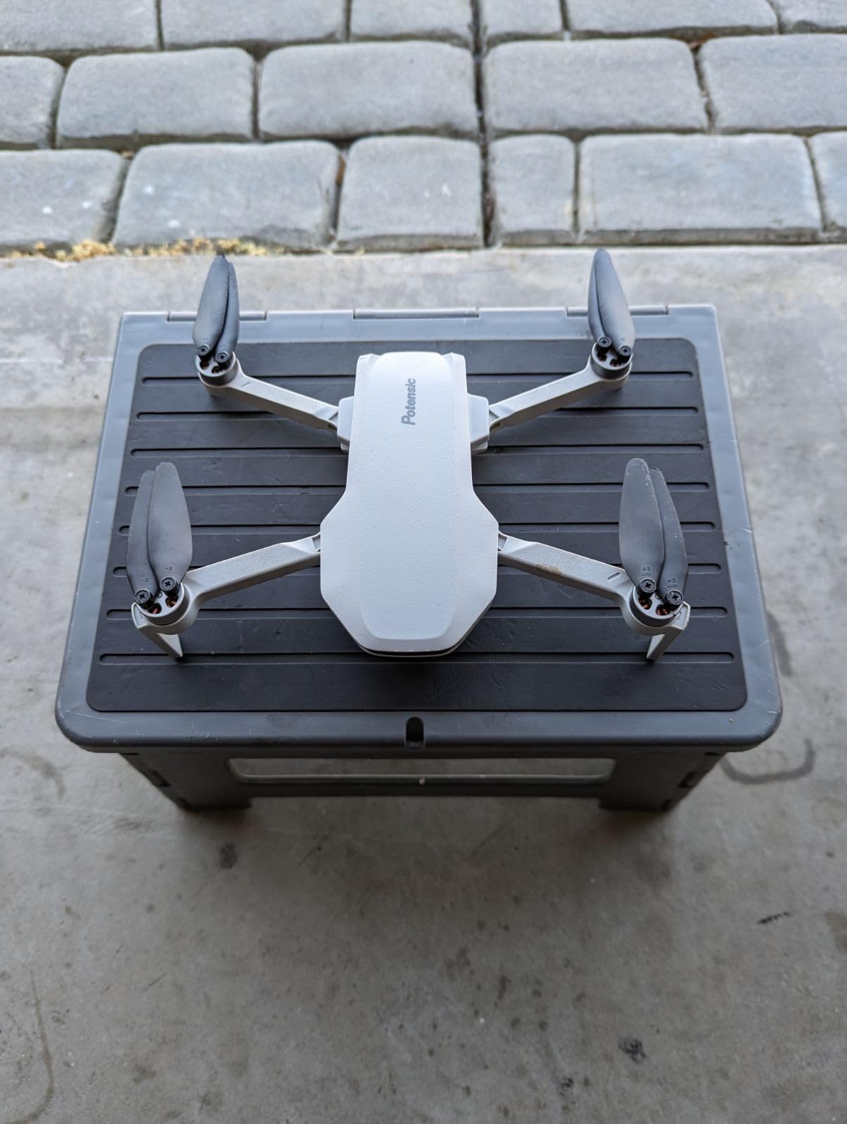
The ATOM SE is the least committal way to find out whether mountain drone work suits you. At 8.8 ounces it folds into a jacket pocket, sits under the 249 g threshold, and ships with two batteries that together deliver 62 minutes of flight time. Nothing about it demands a new pack or a new habit.
For a first ridge flight that is the right trade. The folding design, level-5 wind resistance from brushless motors and a 16 m/s sport mode top speed are enough to get a summit reveal, and GPS auto return, Follow Me, Waypoint Flight and Circle Flight cover the shots beginners want to make.
One safety detail deserves attention. The flexible propeller blades swing out in flight rather than snapping, which reduces the finger injury risk that matters on rocky, awkward launch sites where you are handling a live aircraft at arm’s length.
Stabilisation is electronic rather than mechanical. ShakeVanish smooths the image across a 118 degree field of view with a vertical tilt range from plus 20 to minus 90 degrees, and for slow scenic movement and time-lapse that is generally enough. It is not enough for fast handheld-looking pushes on a ridgeline.
The 1/3-inch CMOS records 4K at 30 fps with 12 MP stills, and PixSync 2.0 control gives up to 4 km of transmission. Owners report real range falling well short of the claimed 13123 ft in obstructed areas, which on a mountain means wooded valleys rather than open ridge lines.
Two build reports are worth knowing: a cracked antenna and a broken joystick after minor use, plus batteries that lose charge in storage. If you are buying for a season of use rather than a single afternoon, factor in spare batteries and a spare controller.
Why it is a sensible first mountain drone
Portability removes the main reason people never take a drone up a hill. If the aircraft lives in a jacket pocket, you will take it on the ridge in poor weather and the golden hour instead of leaving it in a cupboard.
It stays under 249 g so recreational flight needs no registration, and two batteries plus a shoulder bag mean you are not managing a charging problem on your first trip out.
Where the compromise bites
No obstacle avoidance sensors at all, and a fixed lens with no optical or digital zoom, so a distant summit cannot be tightened. On exposed terrain the absence of sensing is the thing to plan around rather than the sensor size.
Video is 4K/30fps only, and the controller build is the most reported weak point. If you plan to keep it, keep spare batteries in your pack.
How to Choose a Drone for Mountain Work in 2026
Sensor size is the argument everyone starts with, and on a mountain it is usually the third question. Wind tolerance decides whether the aircraft comes home, altitude capability decides whether it can launch at all, and battery temperature decides how much of the published flight time you actually get. Sensor size decides whether the files are good enough to use, which matters, but it is not what grounds the aircraft.
Wind resistance: what the Level 5 rating means on a ridge
Wind ratings are measured in a controlled test, on flat ground, with steady air. Mountains produce neither. A ridge generates orographic lift on the windward side and rotor turbulence on the lee side, a canyon squeezes and accelerates the flow through a venturi effect, and a summit funnels gusts into a rotor that can double the instantaneous wind speed every few seconds.
Read the published number as a threshold for a controlled hover, not as a weather forecast for your launch site. The DJI Mini 3 and the Potensic models are rated at level 5, and the Autel publishes 27 mph. In practice, treat a level 5 rating as comfortable working range up to about two-thirds of that figure on an exposed crest, and expect a larger aircraft to keep flying in conditions that ground a small one.
Altitude: service ceiling versus usable ceiling
Two different numbers get confused constantly. Maximum takeoff altitude is the elevation at which the aircraft will still arm and lift off. Service ceiling is the height at which it can hold position and fly normally. The gap between them is where everything goes wrong.
Thin air reduces rotor efficiency, so the same wind produces more control input and more battery draw, and motors run hotter. Cold raises the internal resistance of a lithium polymer pack, which means less usable capacity from the moment you take it out of the case. The DJI Mini 3 is the only aircraft here with a published takeoff figure, up to 4000 meters; for the others, treat the aircraft as altitude-limited by its own low-voltage and temperature warnings rather than by a printed number.
A practical rule: above roughly 3000 m, plan a third fewer flight minutes than the specification claims, launch with a warm pack, and never leave a battery in a vehicle overnight in freezing conditions. Cold-soaked packs are the most common cause of a drone that will not arm on a cold summit.
Cold batteries and dawn launches
A lithium polymer pack at near freezing delivers noticeably less than the same pack at room temperature, and the drop is amplified by altitude. Keep spares inside your jacket rather than in an outside pocket, and treat the first pack of the day as a warm-up pack rather than a hero pack.
Charging in the backcountry needs planning too. Parallel hubs on the Potensic ATOM and the DJI Combo Plus packages cut turnaround time dramatically compared with charging one pack at a time, which is why the ATOM’s three-battery configuration is an endurance argument as much as a capacity one. A car inverter or a capable power bank is the other half of the plan.
Sensor size, gimbal and the light you actually get
The mountain light problem is contrast, not brightness. A sunlit snowfield next to a shadowed foreground can exceed what a small sensor holds. A 1-inch sensor gives you the headroom to expose for the snow and keep the shadow, and an adjustable aperture lets you make that decision yourself rather than handing it to an auto exposure.
Stabilisation is the second half. A 3-axis mechanical gimbal holds a ridgeline push-in smooth in moving air, while electronic stabilisation on a 1/3-inch sensor produces visible warping at the frame edges when you move quickly. If your mountain footage has movement in it, the gimbal matters more than the megapixel count.
On bright snow and sand, exposure compensation and ND filters work together. A fixed ND set lets you hold a fast shutter through midday glare without dropping the aperture so far that depth of field becomes an issue, and several packages here include an ND8/32/128 set.
Signal range with no line of sight back
Published transmission ranges assume open air. On a mountain the aircraft is usually behind a ridge, behind a forest, or inside a valley with rock walls, and all three reduce the usable link well below the printed number. Dual-band systems and frequency hopping help, but geometry beats both.
Plan your missions so the aircraft flies with terrain behind it rather than between it and you, keep a return-to-home altitude above the intervening ridge, and treat a sudden video feed freeze as a signal to fly the aircraft toward open air rather than pressing on.
Budget for the whole kit, not the airframe
Every weight quoted by a manufacturer is the airframe. Your real number is the aircraft plus a minimum of three batteries, the controller, the charging hub or charger, spare propellers, and a card, in a pack that has to survive a descent. A 249 g drone with two batteries and a phone-mounted controller can weigh more in your bag than a heavier aircraft with fewer packs.
Count batteries first. Two spare batteries turn a single-pack day into a three-pack day, and on mountain light, a second flight window at golden hour is usually worth more than a larger sensor used once. ND filters come after the batteries, not before. If you are choosing between a third battery and a filter set, take the battery, and if you need a way to record sound in the wind, our guide to microphone windshields for outdoor filming covers the other half of mountain audio.
Drone Rules for Mountain Launch Sites in 2026
Mountains have more rules than open fields, and the rules that bite hardest are the ones that vary by site. The United States baseline is weight-based: an aircraft at or under 250 g does not require registration for recreational flight, and anything above it does. Four drones in this roundup sit under that line, and three sit above it, including the Air 3S at 724 g and the Ruko at 360 g.
Remote ID is a separate requirement for aircraft above 250 g, and it is the reason the weight threshold matters even for people who never intend to fly commercially. Paid work carries its own obligations on top of registration, including the pilot certification that goes with commercial operation.
Protected areas are the most common blocker and the least discussed. National parks, monuments and many wilderness areas in the United States restrict or ban drone launch and landing outright, and mountain terrain is where those designations concentrate. A quick check of the site rules before you walk in is faster than any amount of explanation at a trailhead.
Two practical habits. Check airspace and local restrictions for the area you are flying in rather than the launch point, and at a shared launch site keep your aircraft on the ground until the other pilot has taken off and moved clear. Ridge launches get busy at sunrise in the season, and the etiquette is what keeps it pleasant for everyone.
One buying note that costs nothing to follow. Marketplace resellers dominate search results for these aircraft, and grey-market units can arrive with firmware that is not current and warranty service that is difficult to claim. An authorised retailer costs the same and gives you a unit the manufacturer will actually service, which matters when a gimbal fault stops a two-day trip.
Frequently Asked Questions
What type of drone is best for high altitudes?
The DJI Mini 3 is the best fit for high-altitude mountain filming because its brushless motors are documented for takeoff at up to 4000 meters while the airframe stays under the 249 g registration threshold. For every other model, treat altitude as limited by battery temperature and low-voltage warnings rather than a published number. Above roughly 3000 m, plan a third fewer flight minutes than the specification claims and keep spares inside your jacket so they start warm.
How windy is too windy for drones?
Published wind ratings describe a controlled hover on flat ground, not a mountain. Treat a Level 5 rating as comfortable working range up to about two-thirds of that figure on an exposed crest, because ridges generate rotor turbulence and canyons accelerate flow well above steady readings. Around 20 mph, only a larger aircraft will usually stay planted, and at 25 to 30 mph most mountain pilots land and wait. If the wind is gusting rather than steady, the gust peak matters more than the average.
What drone is best for hiking footage?
The DJI Mini 3 leads for hiking because it weighs 248 g, needs no registration for recreational flight, and has a 3-axis mechanical gimbal rather than electronic stabilisation. The Potensic ATOM SE folds into a jacket pocket at 8.8 ounces if you want the lightest option, and the Potensic ATOM adds three batteries for 96 minutes of total flight time when your day is longer than the light.
Do I need a license to fly a drone in the mountains?
In the United States, registration is required for any aircraft above 250 g, and Remote ID applies to those same aircraft. Drones at or under 250 g, including the DJI Mini 3, the DJI Mini 5 Pro, the Potensic ATOM, the Potensic ATOM SE and the Skyrover S1 Mini, do not require registration for recreational flight. Paid or commercial work carries separate certification obligations, and national parks and monuments often restrict or ban drones entirely, so check site rules before you walk in.
How cold can a drone battery get?
There is no published temperature figure to quote, so treat the behaviour instead. A lithium polymer pack kept at near freezing delivers noticeably less capacity than the same pack at room temperature, and the loss grows with altitude because thin air already reduces rotor efficiency. Keep spare batteries inside your jacket rather than an outside pocket, never leave packs in a vehicle overnight in freezing conditions, and treat the first pack of a cold day as a warm-up rather than a hero pack.
Are drones worth it for mountain filming?
Yes, for the shots a hiker cannot reach on foot: ridgeline reveals, valley parallax, and a scale reference for terrain that flattens everything else. The value drops sharply when the wind is above your aircraft’s rating or the light is only twenty minutes long, because you will spend batteries and get nothing. Plan two flights rather than one, budget three batteries, and choose your launch site on the sheltered side of the crest.
Final Verdict: The Best Drones for Mountain Filming in 2026
The DJI Mini 3 is our pick for the best drones for mountain filming because it solves the three constraints that actually bite: it stays under the registration threshold, it carries a mechanical gimbal, and it is the only aircraft here with a documented takeoff altitude. Take it when the walk is long, the light is short and the paperwork is the last thing you want to think about.
The DJI Air 3S takes over the moment the forecast turns gusty or the shot needs to be 6 stops under a snowfield. Its dual cameras, 14 stops of dynamic range and planted 724 g airframe produce the best files here, and the 724 g weight is the price of admission. The DJI Mini 5 Pro is the answer when you need 1-inch quality at 249 g and can pick your launch sites for shelter.
Beyond the top three, the Autel EVO II Pro V3 wins on manual exposure and low light, the Potensic ATOM wins on total endurance with three batteries, the Skyrover S1 Mini wins on 4K/60fps under 250 g, the Ruko F11PRO 2 Plus wins on 48 MP stills, and the Potensic ATOM SE wins on being small enough that you will actually take it up the hill.
Whichever you choose, budget the batteries before the accessories, fly from the sheltered side of the ridge, and check the site rules on protected land before you walk in. If you want the reasoning behind a different part of the kit, our guide to cameras for filming and our micro drone picks for urbex cover the gear that sits either side of the mountain kit.