
Choosing a drone for a construction site survey is harder than it looks, because the aircraft most people picture is usually the wrong tool. A high-resolution camera is not the same as a survey-grade mapping camera, and a large sensor does nothing for the ground sample distance your client actually needs. Our team flies active job sites, so we built this list around the question that matters: does the airframe give you repeatable, georeferenced data you can measure from, not just good-looking photographs.
This is where the best drones for construction site surveys split into two very different groups. Documenters and progress-monitoring pilots want endurance, obstacle avoidance and a screen that reads well in glare. Surveyors want an RTK or PPK positioning chain, a mechanical shutter, repeatable grid missions and a ground sample distance tight enough for volumes and stakeout. Only a few of the aircraft below do the second job natively, and it is worth knowing which category you are shopping in before you spend anything.
If your boss simply wants aerial photos of the site, the construction site documentation guide covers that side. If you are chasing topographic output, our aerial mapping and topographic survey roundup goes deeper on the photogrammetry side. This article is the version that includes the measurement-grade options.
What Is the Best Drone for Construction Surveying?
The best drone for construction surveying is an RTK-equipped mapping aircraft that flies automated grid missions at fixed overlap and altitude, geotags every frame to centimetre-level accuracy, and feeds that data into photogrammetry software. In practice that means something like the Autel EVO II Dual 640T RTK V3 for thermal plus RTK work, or a DJI enterprise platform for all-weather sites, while lighter platforms such as the DJI Mavic 3 handle progress documentation well.
One caveat up front: none of the aircraft in this roundup is a certified survey instrument. A drone survey still needs ground control points, a flight plan with consistent forward and side overlap, and a human check of the result before it goes anywhere near a payment claim.
Top 3 Best Drones for Construction Site Surveys in October

DJI Mavic 3
- 4/3 CMOS Hasselblad sensor
- 46-minute single-battery flight time
- Omnidirectional obstacle sensing
- 895 g airframe

Autel EVO II Dual 640T V3
- 640x512 thermal sensor
- 50MP 0.8 inch visible sensor
- 38-minute flight time
- 19 sensor groups for 3D path planning

Autel EVO II Dual 640T RTK V3
- Centimetre-level RTK positioning
- NTRIP and PPK post-processing
- Double grid mapping missions
- Three batteries in the bundle
The 6 Best Drones for Construction Site Surveys at a Glance in 2026
| Product | Specifications | Action |
|---|---|---|
| DJI Mavic 3 |
|
Check Latest Price |
 DJI Mavic 4 Pro Fly More Combo DJI Mavic 4 Pro Fly More Combo |
|
Check Latest Price |
| Autel EVO II Dual 640T V3 |
|
Check Latest Price |
 Autel EVO MAX 4N V2 Autel EVO MAX 4N V2 |
|
Check Latest Price |
 DJI Matrice 4TD DJI Matrice 4TD |
|
Check Latest Price |
| Autel EVO II Dual 640T RTK V3 |
|
Check Latest Price |
One thing to notice in that table: only the last row carries a native RTK positioning chain, and only the last two carry a thermal payload. Everything else is a documentation-first airframe, which is a perfectly good purchase if your deliverable is progress photos, bid context shots and a stakeholder update.
1. DJI Mavic 3 – the workhorse for multi-pass site coverage
Pros
- 4/3 CMOS Hasselblad sensor with 12.8-stop dynamic range
- 46-minute single-battery endurance
- Omnidirectional obstacle sensing
- Stable flight in windy conditions
- 15 km O3 Plus live feed
Cons
- Batteries charge in the aircraft so a second cradle is needed
- No independent left-right camera pan
- SD card slot is awkward to reach
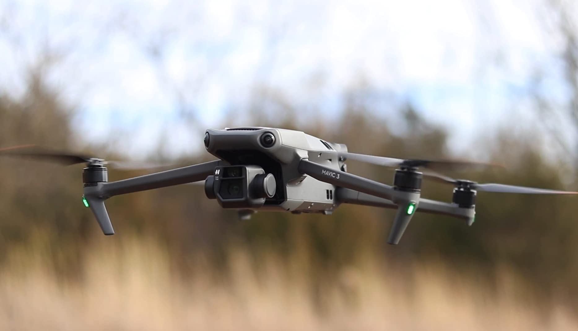
This is the aircraft we end up flying most when a job is about coverage rather than measurement. The 46-minute figure is a single-battery number, so on a site that takes two sorties to cover you are looking at roughly 90 minutes of flying before battery swaps, and that is what makes it the endurance pick on this list.
The Hasselblad 4/3 CMOS sensor with 12.8 stops of dynamic range does the heavy lifting. On a mixed site with bright sky, dark scaffolding shadow and pale concrete, that extra latitude is the difference between a usable frame and one that blows out on the top third.
The airframe itself is 895 g, which matters more than it sounds when you are carrying it up a stair core or setting up on a rooftop. Maximum flight distance is listed at 30 km and the service ceiling above sea level is 6000 m, so altitude is not the constraint on most sites. The listed operating range is -10 to 40 C, so cold winter mornings at northern sites need a battery warm-up habit.
The box is a single-battery kit with the RC-N1 remote, three low-noise propeller pairs, a 65W portable charger and a storage cover, so the first thing to add is a second charging cradle. Carbon fibre construction is a good sign for a platform that will be flown in rain and dust all season.
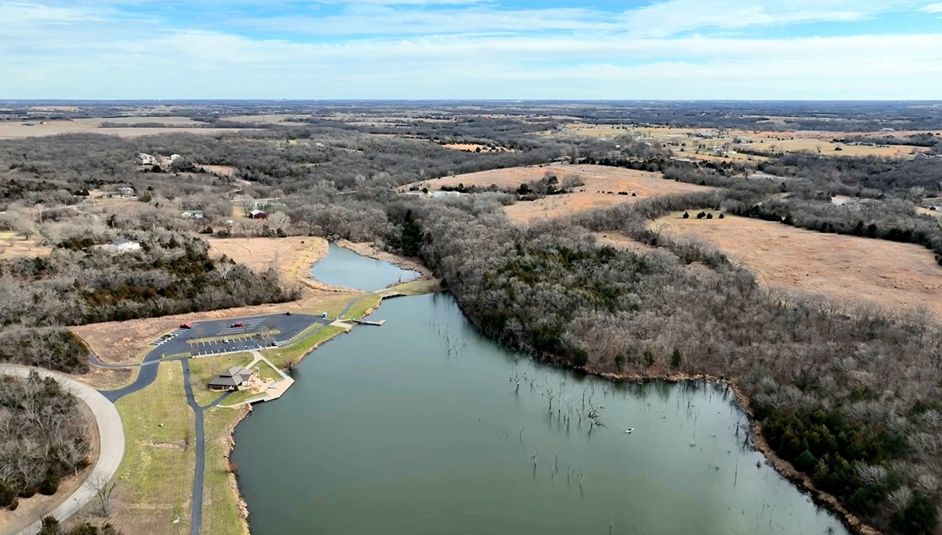
Where it fits in our workflow: end-of-week progress passes, safety walkaround imagery, client presentation stills and stockpile context shots. The omnidirectional obstacle sensing lets you work close to partially built structures without parking a spotter on every side, and reviewers consistently report stable behaviour in wind.
The limitation that matters for survey work is positioning. There is no RTK module in this configuration, so every frame relies on the onboard GNSS solution, which means your orthomosaic accuracy will lean entirely on ground control points and good image overlap. For a visual progress record that is fine. For a volume calculation someone will dispute, you need one of the RTK platforms further down this list.
What it does well on a live site
Long single-battery endurance and obstacle sensing together mean fewer takeoffs on a sprawling site, which is where most site time actually goes. The 15 km transmission link keeps a comfortable video feed for site managers standing at ground level.
The dynamic range also means you can shoot at times of day that would ruin a lesser sensor. Overcast mid-morning light, which is when most sites are actually workable, is exactly where an extra 12.8 stops pays off.
Where it will frustrate you
Charging batteries inside the aircraft is the most-cited annoyance. On a two-person crew covering a big site, you will want a second charging cradle so you are not waiting on the airframe to top up.
There is also no independent left-right camera pan despite a physically movable gimbal, and digital zoom past 14x jumps rather than transitions smoothly. If you need to inspect a facade from a fixed standoff, that zoom behaviour is worth testing first.
2. DJI Mavic 4 Pro Fly More Combo – the resolution pick for close inspection
Pros
- 100MP 4/3 CMOS Hasselblad stills sensor
- Dual tele cameras for usable zoomed inspection imagery
- 0.1-lux omnidirectional obstacle sensing for low light
- 51-minute flight time with three batteries included
- Parallel charging hub in the combo
Cons
- DJI Fly app must be downloaded directly from DJI
- Combo package weight of 4222 g is heavy over rough terrain
The Fly More Combo is the version to buy if you are covering a site alone, because the three batteries and the parallel charging hub are what make a full day possible without a generator. The 51-minute figure is the longest single-battery endurance of any airframe here.
That 100MP 4/3 CMOS sensor is the draw for survey-adjacent work. At high altitudes you can crop into a region and still hold enough pixels for a useful inspection frame, which means fewer low passes over areas where you do not have permission or clearance to fly.
On paper it is also the more capable link: 30 km O4+ transmission with 10-bit HDR and a stated latency under 150 ms, across a controller with a 7-inch rotatable high-bright screen. For a site manager working from a ground station at the gate, that is a meaningfully better feed than a standard phone controller.

Reviewers rate the dual tele cameras highly for close inspection work, and the 0.1-lux omnidirectional obstacle sensing genuinely helps on dawn and dusk progress flights, which is when many crews shoot to beat the heat and the traffic.
Again, this is a documentation platform rather than a measurement one. It has no RTK chain in the standard configuration, so treat its output as evidence imagery, not as a source for stakeout or volume takeoff unless you are prepared to control the survey with ground control points and careful overlap.
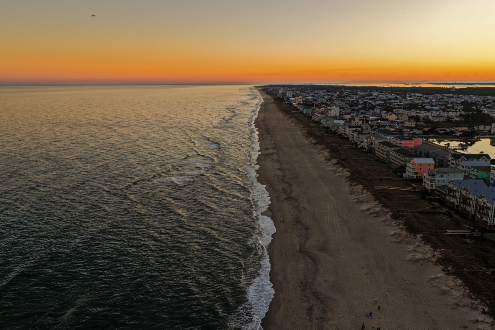
What it does well on a live site
Three batteries plus a charging hub means a single operator can fly a full day without swapping roles with a second pilot. On a site where the useful flying window is only a few hours, that is a real throughput difference.
The zoom reach and the high-resolution sensor reduce the number of flights you need for facade, pre-cast panel and rebar inspection shots, and the bright 7-inch rotatable controller screen stays readable in open sun.
Where it will frustrate you
The DJI Fly app being pulled from Google Play is the practical headache most reviewers mention. You install it from the DJI site instead, which is a five-minute job but an annoying one to explain to a new team member on their first day.
The combo package weight of 4222 g is worth thinking about on rough or elevated terrain. Carrying it to a rooftop start point rather than a ground-level one is a different day.
3. Autel EVO II Dual 640T V3 – the dual-sensor entry point for thermal and visual work
Pros
- 640x512 thermal sensor with 10+ palettes and D-RI ranges
- 50MP visible sensor with 4x lossless zoom
- 38-minute flight time with three batteries
- 360-degree obstacle avoidance
- Free IR analysis software
Cons
- Autel accessory mounts are not supported on this line
- A thermal module failure was reported within the first year
- Extended support plan sold separately
If your site work involves more than a single sensor, this is the cheapest route on the list to getting two. The gimbal carries a 640×512 thermal sensor and a 50MP 0.8 inch visible sensor at the same time, so one sortie covers both the visual record and the thermal anomalies.
Picture-in-picture overlay is the feature that gets used most on a construction site. Seeing the thermal image framed inside the colour image makes it far easier to line a defect up with the structure it belongs to, and the 10+ measurement modes including spot, regional and isotherm are what turn a hot pixel into a reportable finding.
The thermal side is a 640×512 sensor at 30 fps behind a 13mm lens with 16x digital zoom, with subject recognition rated out to 100 m. That is a short throw compared with a dedicated radiometric camera, so plan your stand-off distances accordingly rather than expecting small far-field defects to resolve.
It weighs 2.5 pounds in carbon fibre, which keeps it manageable for a one-person team, and multiple buyers report responsive US warranty and technical support through an authorised Autel Robotics USA channel.

The 38-minute flight time is the shortest of the airframes here, and that is partly offset by three batteries in the bundle plus a multi-charger. The 19 sensor groups, including 12 visual sensors feeding real-time 3D map building and path planning, are what let it hold a route through a cluttered site rather than requiring a hand-flown approach.
Reviewers moving from DJI platforms report an easy transition, with comparable menus and solid stability. The recurring complaint is accessory compatibility: this line does not accept Autel mounts, so if you plan to grow into payload-based work later, you should think about an Enterprise variant from the start.

What it does well on a live site
Dual-sensor capture in one flight is the whole point. Commissioning, roof membrane and envelope work all need both the colour context and the thermal evidence, and doing them together halves the flights.
SkyLink 2.0 transmission runs 15 km with tri-band 2.4GHz, 5.8GHz and 900MHz support, and the tri-band behaviour is what keeps the link stable on a site full of steel and concrete that reflect and block signals.
Where it will frustrate you
No RTK on this model. You are georeferencing the thermal hits with the standard GNSS solution, so expect to add control work if you intend to record defect coordinates for a handover document.
One buyer reported a thermal module failure inside the first year, and a case camera-cover attachment point cracked. Neither is a pattern in the review data, but both are reasons to keep the support plan in your budget rather than treating it as optional.
4. Autel EVO MAX 4N V2 – the four-sensor platform for night work and laser measurement
Pros
- Four integrated sensors in a single airframe
- Starlight camera performs in genuine darkness
- Laser rangefinder measures 5-1200 m at plus or minus 1 m
- 720-degree radar-assisted obstacle avoidance
- Anti-GPS-spoofing and anti-RFI flight control
Cons
- Thermal detail is limited when zoomed in for precise defect location
- Autel accessory mounts are not supported on this line
Four sensors in one airframe is the headline: a starlight night camera rated at 0.0001 lux, a 50MP 1/1.28 inch wide camera, a 640×512 thermal sensor and a laser rangefinder covering 5 to 1200 metres at plus or minus 1 metre accuracy.
The laser rangefinder is the piece that matters most on a construction site. It lets you hold a known target and get a distance back, which is genuinely useful for confirming storey heights, facade offsets and crane reach without needing a second crew member with a tape.
Starlight is not a gimmick. It can resolve light sources at 5 km and more, and reviewers report it holding up in genuine darkness, which is what makes overnight pour schedules and night-shift progress monitoring possible at all.
SkyLink 3.0 uses six antennas across four frequency bands with AES-256 encryption and 1080p at 60 fps, with optional 4G for relay work. A-Mesh 1.0 drone-to-drone networking is the more interesting feature for a large site, because it lets a second aircraft act as a relay when a structure blocks the link.
One practical note: the base kit ships with a single battery. The ABX41-D pack is hot-swappable with in-place detection, so buying spare packs up front is what turns that 42-minute figure into a real workday.
What it does well on a live site
The 720-degree obstacle avoidance combines binocular vision with millimetre-wave radar detecting down to 0.5 inches. Radar is what lets it work around rebar, scaffolding tubes and partly installed facade where a purely optical system struggles.
Anti-RFI, anti-EMI and anti-GPS-spoofing flight control is aimed squarely at industrial sites near power lines and critical structures, where radio interference and satellite interference are genuine operational risks. The 42-minute flight time and the hot-swappable ABX41-D battery make extended multi-sortie days straightforward.
Where it will frustrate you
Thermal detail at 640×512 is limited when you zoom in to locate a defect precisely. It will tell you that something is warm; it will not tell you which of six hot rebar points is the problem.
Review volume on this listing is very small, so treat published buyer feedback as directional rather than statistical. Plan your own acceptance flight and confirm the sensor package behaves the way you need before you commit a project to it.
5. DJI Matrice 4TD – the all-weather enterprise airframe for exposed sites
DJI Matrice 4TD Quadcopter with RC Plus 2 Enterprise, Thermal, Wide & Tele Lenses, Laser Range Finder, Low-Noise Anti-Ice Propellers, IP55
Pros
- IP55 weatherproofing for rain dust and freezing conditions
- Low-noise anti-ice propeller technology
- Triple-lens array plus high-resolution thermal sensor
- Built-in laser range finder for precise target location
- RC Plus 2 Enterprise controller and battery included
Cons
- AL1 spotlight can trigger front and side detection warnings
- DJI Care is unavailable in the US so third-party cover is needed
This is the only airframe here with a documented IP55 rating, and that single spec is why it earns a place on any site list. Construction sites are wet, dusty and freezing at different months of the year, and IP55 is the difference between flying on schedule and waiting for weather.
The sensor stack is a triple-lens visual array plus a high-resolution thermal sensor and an NIR auxiliary light, with a built-in laser range finder for precise target and asset location. One owner reported reading signage on a water tower roughly 10 miles away, and thermal zoom is praised for pinpointing hot spots on arrays like solar panels.
Real-world endurance from the published review data runs roughly 30 to 35 minutes per battery in 20 mph wind with 30 mph gusts. That is the honest number to plan around, not a headline figure, and it is still enough for a mapped pass over a typical site block.
It lists at 10 pounds with a 5000 mAh lithium polymer battery, and the box includes the aircraft, one flight battery and the RC Plus 2 Enterprise controller so a new team can fly the same day it arrives. At that weight it is a two-person carry or a vehicle-mounted setup rather than a walking job, which is normal for an enterprise platform.
What it does well on a live site
Weather tolerance is the headline advantage. Anti-ice propellers plus IP55 bodywork mean the aircraft keeps flying through conditions that would ground a lighter platform, and on a schedule-driven job that is worth more than any spec sheet number.
DJI Dock 3 compatibility and FlightHub 2 integration mean this aircraft can be part of an automated, remote programme rather than a one-person manual sortie. If you are monitoring several sites, that is the difference between a drone pilot and a drone programme.
Where it will frustrate you
The AL1 spotlight interferes with front and side object detection and produces warning prompts, which is annoying on a cluttered site where detection warnings cost you time.
DJI Care is unavailable in the US for the foreseeable future, so a third-party service plan is the practical route for enterprise coverage. Published review volume here is two entries, so acceptance-test the airframe against your own site conditions before you standardise on it.
6. Autel EVO II Dual 640T RTK V3 – the centimetre RTK platform for thermal survey work
Pros
- Centimetre-level RTK via NTRIP base station or PPK
- Supports PPK post-processing without ground control points
- Autel Explorer double grid and polygon missions with saved profiles
- 640x512 thermal plus 50MP RYYB visible sensor
- Three batteries chargers and carry case included
Cons
- Almost no published buyer feedback so reliability is unproven
- Autel accessory mounts are not supported on this line
This is the only aircraft here with centimetre-level RTK positioning, and that single spec changes what you can deliver. RTK works over NTRIP networks, third-party base stations, or PPK post-processing of the onboard log, so you can get centimetre-grade georeferencing without laying out control across the site first.
Autel Explorer handles the mission planning side: rectangular and polygon missions, double grid patterns, customisable course headings, saved NTRIP profiles and photo replication. Photo replication is the underrated one, because it lets you re-fly the exact same geometry on the next site visit, which is what makes period-over-period progress comparison meaningful.
The owner who reviewed this listing described the RTK module as the feature that materially improved inspection work, because a thermal hit can be paired with an accurate fix location instead of an approximate grid reference. That is the whole argument for this platform in one sentence.
The thermal payload is a 640×512 sensor behind a 13mm lens refreshing at 30 Hz with 4x lossless and 16x digital zoom, detecting from 2 to 20 m, with temperature deviation specified within plus or minus 3 C. The visible side is a Sony 0.8 inch 50MP RYYB sensor with a Moonlight Algorithm 2.0 for low-light capture, and the airframe weighs 2.8 pounds.
What it does well on a live site
Combining a thermal sensor and a 50MP RYYB visible sensor in an RTK airframe means defect location, temperature and georeference come from a single sortie. On a pre-handover defect schedule that is the difference between a list and a defensible record.
Three batteries total, a charging hub, spare propellers and a carry case are in the bundle, and the Smart Controller V3 has a 7.9-inch 2000-nit display with IP43 protection, which stays readable in full sun on an open site.
Where it will frustrate you
There is almost no published buyer feedback for this listing, so long-term reliability is unproven from the buyer side. The free IRPC analysis tool handles report generation from imported thermal images, but budget time to learn it rather than assuming it is plug-and-play.
Like the other EVO II models here, it does not accept Autel accessory mounts. If your roadmap includes a LiDAR payload or an external sensor, verify the fit before you standardise on this airframe.
How to Choose a Survey Drone for a Construction Site
Most buyers pick the camera first and regret it. Start from the deliverable your client actually asked for, because progress photos, a topographic surface model and a stockpile volume are three different products with three different sensor requirements.
We compared all six airframes in this roundup on the same criteria, and the honest finding is that the documentation tier and the survey tier barely overlap. If you need a measured number, you need RTK or PPK and a repeatable grid mission. If you need a good photograph, you need resolution, dynamic range and obstacle avoidance.
Getting sub-5cm accuracy: RTK, PPK and ground control points
RTK corrects the aircraft position in real time against a correction stream, which is why the EVO II Dual 640T RTK V3 is the accuracy pick here. PPK records the raw GNSS log and corrects it after the flight, which is slower to process but lets you fly without a live correction link.
Ground control points still matter, even with RTK. Practitioners report the best results from combining RTK with a small number of well-surveyed checkpoints rather than relying on either alone, and the checkpoints are what let you prove the accuracy of a specific deliverable rather than assume it.
Ground sample distance is the number that decides whether your output is usable. Coarser GSD is fine for stockpile volumes and site-wide surfaces; if you need to trace a joint, a leak path or a stakeout line, you need tighter GSD, which means flying lower, which means more sorties and better control.
Photogrammetry or LiDAR for a construction site?
Photogrammetry wins on texture-rich, well-lit ground: bare earth, compacted haul roads, finished surfaces and stockpiles. It produces colour, it is fast, and for most earthworks and progress monitoring on a construction site it is the right default.
LiDAR wins where the ground does not photograph well. Vegetation, deep shadow under a partially built structure, water and low-texture sand are exactly the cases where photogrammetry produces a lumpy surface, and LiDAR pulses straight through canopy to reach the ground beneath.
On an active site the deciding factor is often occlusion. A half-built structure with open floor slabs creates shadowed pockets that no number of flight lines will fully resolve from the air, and a ground-based or LiDAR approach may simply be cheaper than flying more.
What a survey drone actually costs to run
Buying the airframe is the small part. The running cost of a survey programme is dominated by software licences, batteries, insurance, pilot training and the labour to place and check control points, and a team that models only the purchase price arrives at a wrong number.
Processed mapping output, reporting and cloud storage are typically licensed per user per year, and those licences are what convert a cheap airframe into an operating cost you have to plan for. Batteries are a wear item replaced on a cycle measured in flight hours, not calendar time.
Liability cover is not optional on a site. Clients, general contractors and public authorities all expect evidence of insurance before a drone flies on their property, and that sits in the annual budget alongside the hardware replacement reserve.
FAA rules for construction survey flights
Yes, you need a licence to do drone surveys commercially. In the United States that means a Part 107 certificated remote pilot, plus registration, plus airspace authorisation for the specific location you are flying.
Standard operations are flown within visual line of sight, in daylight, below 400 feet. Beyond that, beyond-visual-line-of-sight waivers and night operations are separate approvals, and both come up in real construction work when you are monitoring progress overnight or covering a site too large to see from one position.
For anyone working under Transport Canada rules the equivalents apply: registration thresholds, a basic or advanced pilot certificate depending on the operation, and a site-specific flight review for built-up areas.
Real construction site problems and how to work around them
Reflectance is the biggest one. New concrete, wet slabs and rebar grids produce specular highlights and repeating features that confuse the matching software, and the fix is a flight window with flat, diffuse light plus a small number of well-placed ground control points.
Dust and particulate haze cut image sharpness at distance, which inflates your ground sample distance without you noticing. Fly earlier in the shift before site dust peaks, and check a handful of frames on the ground before you pack up.
Partially built structures occlude the ground beneath them, and no flight plan from the air fixes that. Plan control points under cover before the structure goes up, because once a slab is poured those points are gone.
Wind at height is worse than wind at ground level, and a tall structure generates its own rotor. Reviewers report the enterprise platforms holding roughly 30 to 35 minutes per battery in 20 mph wind, which is the figure you should size your sortie plan around.
What you can actually deliver to the client
An orthomosaic is a stitched, georeferenced image of the site with no perspective distortion, and it is what most clients picture when they ask for a drone survey. The point cloud underneath is the raw 3D data. A DSM models the surface including structures and vegetation; a DEM models bare earth only.
Volumetric stockpile calculation comes from comparing two surfaces over time, a 3D model and DWG export come from the mesh, and a date-stamped progress PDF comes from the orthomosaic. Engineers usually want the DWG and the surface model; clients usually want the visual report, and the same flight produces both.
One note on evidence: date-stamped, repeatable flight geometry is what makes a progress comparison defensible. That is worth more than any single impressive frame when a payment claim is being argued.
One airframe or two: what practitioners actually do
People in the Pix4D community consistently describe splitting the fleet rather than stretching one platform across both roles: a Mavic-class aircraft for inspections, project tracking and smaller mapping missions, plus a Matrice-class aircraft with an integrated payload for large mapping and survey jobs. That matches what we see on site, where the light platform flies most days and the heavy one flies on survey days.
The same source of friction runs through the beginner questions. On a job forum thread titled simply drone recommendations, a poster asked where to even start when a boss wants aerial site photos, and the honest answer is that photos and surveys are different purchases. If you do end up running two platforms, budget for two sets of batteries, two charging cradles and roughly double the training time.
If you are still narrowing the field, our general construction drone roundup covers the lighter documentation tier, and the job site camera guide is useful if your gap is ground-level imagery rather than aerial capture.
Frequently Asked Questions
What is the best drone for construction surveying?
The best drone for construction surveying is an RTK-equipped mapping aircraft that flies automated grid missions at fixed overlap, geotags every frame to centimetre-level accuracy and feeds photogrammetry software. On this list that is the Autel EVO II Dual 640T RTK V3, with the DJI Matrice 4TD leading for all-weather sites. Lighter platforms such as the DJI Mavic 3 handle progress documentation but lack a positioning chain.
What is the best drone for building inspections?
For building inspections, the Autel EVO MAX 4N V2 and the DJI Matrice 4TD lead this list. Both pair a thermal sensor with a high-resolution visual payload so one sortie gives colour context and heat evidence together. The Matrice 4TD adds an IP55 rating and anti-ice propellers for exposed sites, while the EVO MAX 4N V2 adds a starlight camera for genuinely dark conditions and a 5 to 1200 metre laser rangefinder.
How much does a survey drone cost?
A construction survey drone costs far more than its airframe once you add the running costs. Software licences for processed mapping output, reporting and cloud storage are billed per user per year, batteries are a wear item replaced on a flight-hour cycle, liability insurance is required before you fly on client property, and pilot training plus the labour to place and check ground control points all sit in the budget. The airframe is the smallest line of the total.
Do you need a license to do drone surveys?
Yes. In the United States you need a Part 107 certificated remote pilot to fly a drone commercially, plus aircraft registration and airspace authorisation for the location. Standard operations are flown within visual line of sight, in daylight and below 400 feet. Flying beyond visual line of sight or at night for overnight progress monitoring requires separate approvals, which are common requirements on large construction programmes.
Conclusion: Where to Start With a Construction Survey Drone
The best drones for construction site surveys split cleanly into documentation and measurement, and buying from the wrong column is the expensive mistake. If your deliverable is progress evidence, bid context and client imagery, the DJI Mavic 3 is our pick because of its 46-minute single-battery endurance, obstacle sensing and 4/3 CMOS dynamic range.
If you need close inspection detail and you are flying solo, the Mavic 4 Pro Fly More Combo gives you 100MP stills, dual tele zoom and three batteries with a charging hub in the box. For dual-sensor thermal work without a large commitment, the Autel EVO II Dual 640T V3 is the value pick.
For genuine measurement you want the Autel EVO II Dual 640T RTK V3 with its centimetre-level positioning, or the DJI Matrice 4TD when weather, night work and automated dock programmes decide the job. Our advice for 2026 is to start with one airframe that matches your actual deliverable, buy control points and processing capability alongside it, and hire a specialist for the first few surveys while your process settles.